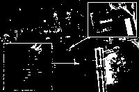
Looks like Google updated its satellite images for Brunswick at the end of September, just in time to capture leaves beginning to change at the start of autumn in Maine. Google’s cameras also captured the first aerial photos of Bowdoin’s recently completed solar installation atop Farley Field House, Watson Arena, Greason Pool, and a standalone series of solar panels constructed on newly acquired land at the former Brunswick Naval Air Station. All of the panels are now visible on Google Maps and on Google Earth. The solar installation, built in partnership with SolarCity, is the largest in Maine.
Google Earth aficionados who want to find them for yourself can plug in these coordinates:
Farley/Watson/Greason: 43˙54’08.32″N / 69˙57’28.91″W
Former Navy Base: 43˙53’46.70″N /69˙57’00.86″W

